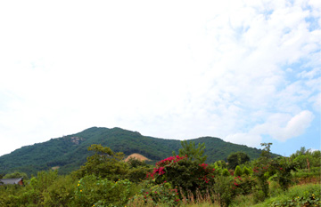
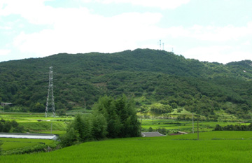
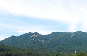
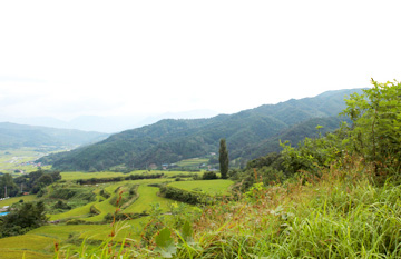
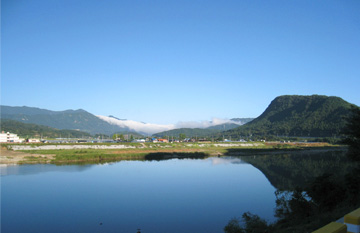
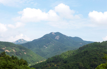
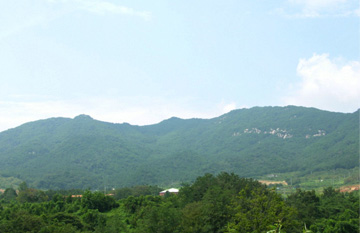
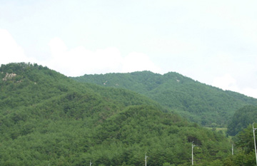
Mountains
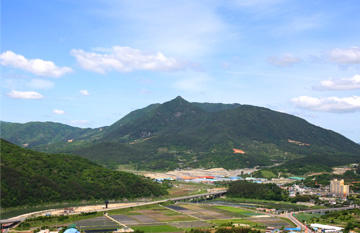
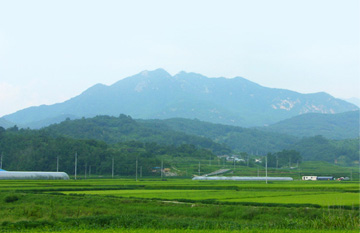
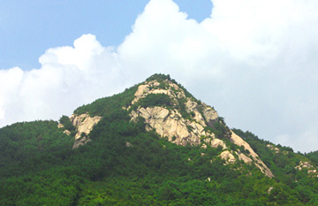
Galjeonsan Mountain is the northernmost mountain within the district of Sancheong-gun and is named “Galjeonsan” in reference to the abundance of kudzu growing in this area. Although the hiking trails are not very well developed, we recommend a visit to this mountain for those hikers who want to explore the northern mountains of Sancheong.
To get to the Galjeonsan Mountain Trail, take National Road 3 from Sancheong-eup and drive in the direction of Hamyang and take Local Road 1034 at the entry to Eoseo-ri (located in Saengcho-myeon). 6 km into Hyangyang-ri, the paved road ends; here, in Eowon-dong Village, take the forest trail on the right-hand side and proceed for 1㎞.
Where the forest trail ends, you’ll find yourself at the entry to the Galjeonsan Mountain Trail proper. The summit of Galjeonsan Mountain is the high peak on the left, and from here you’ll encounter a proliferation of kudzu in the fields. If you continue for 1.5km through the kudzu fields, you’ll reach a fork in the road called the Galbatjae Forked Road. Here, on the right side is the trail toward Cheongsu-ri, Sinwon-myeon, Geochang-gun and on the left is the trail toward the summit.
The distance from this forked road to the summit is 600m. Once you reach the summit, you will be able to see all of the mountains in the Geochang region in the northern part of Sancheong, including Deokgalsan Mountain, Maebongsan Mountain, Boroksan Mountain, and Barangsan Mountain. One regret about Galjeonsan Mountain is that the hiking distance is rather short. For those who want a longer challenge, we recommend proceeding from the summit through Maebongsan Mountain and on to Deokgalsan Mountain across the way, then passing through 630bong Peak and 645bong Peak before descending to Eowon-dong in Hyangyang-ri to get a fuller experience. However, since the mountain trails are faint and the total distance for this itinerary that includes the return trek from Eowon-dong will be 12km, this will be a gratifying hike only for those who are confident about their hiking skills. Come with beloved family members, significant others, and friends to share the pleasure of the beautiful scenery; the bond of your friendship and love will only be strengthened by undertaking the challenge of the hike together.
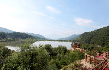
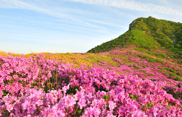
The name of Gugoksan Mountain refers to the nine bends visible in the mountain-scape. It is the gateway to the Golden Ridge; when you stand on the ridge of this mountain, Cheonwangbong Peak of Jirisan Mountain appears close enough to touch. When you climb atop Cheonwangbong Peak, you won’t be able to admire the scenery of Cheonwangbong Peak itself, but when you are standing on Gugoksan Mountain, you’ll have the satisfaction of admiring the royal azaleas in the springtime and the spectacle of the autumn leaves in the fall.
Jirisan Mountain’s Golden Ridge course is a hiking route that delivers both the adventurousness of new mountain trails and the mystique of an ancient and sacred mountain.
This trail takes you far closer to Cheonwangbong Peak, almost under its very nose, and one its delights is wading through the proliferation of up-land bamboo like a true explorer. The starting point is Deokcheonseowon Confucian Academy (Historic Site 305, associated with Nammyeong Jo Sik, the great Confucian scholar of the Joseon Period), which is located at Won-ri, Sicheon-myeon, Sancheong-gun along the route from Jinju to Jungsan-r. The route is as follows: Starting point - Dosolam – Heliport - A large entry sign that says “Nature Conservation” - Summit of Gugoksan Mountain – Golden Ridge. After you pass through the Golden Ridge and immediately before you reach Guksubong Peak, descend into the parking lot in Jungsan-ri.
The highest peak that meets your gaze is the sacred peak named Cheonwangbong Peak. From Peaks emerge one after another from the left, in the order of Chilseonbong Peak, Samsinbong Peak, Chotdaebong Peak, Jangteomok Pass, Jeseokbong Peak, and Jungbong Peak. This area is called the southern ridge. Although there are several mountains that are affectionately nicknamed the “Jirisan Observatory”, Gugoksan Mountain is probably the best because of how close and clear the view is from there. If you proceed from the summit along the same trail for approximately 30m further, you’ll come to a forked road. The trail on the right side is the descending trail that leads you back to the starting point, and the trail on the left heads in the direction of Guksubong Peak. Throughout the descent, you’ll find a heavenly abundance of azaleas. As you hike onward, you’ll be closer and closer to Jirisan Mountain. In around 15 minutes after you start from the summit you will see the heliport from which the descending trail opens in the direction of Dongdang-ri.
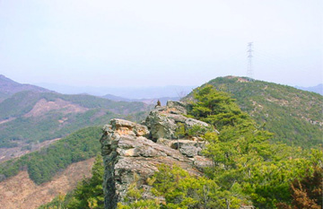
From here begins the area named Golden Ridge. Although the inclined ascent is bearable, the real challenge begins once you meet the forest of upland-bamboo, where the scenery will impress you with its primal feeling. To make it through Sanjuk Saitgil, a trail that leads through bamboo that grows far higher than the height of an adult, you will need to keep your head down and walk with your gaze on the ground. By a rough estimate, you will need to get through over ten of these up-land bamboo groves, ranging in length. You’ll need to take more caution not to lose your way in the bamboo and to manage your physical endurance.
The name “Guinsan Mountain” means that the mountain is very high, since “gu” means nine, the last of the single digit numbers, and “in” was a unit used to count altitude. Alternatively, the name may also mean that there are nine trails in this mountain. Over the years, however, many of these trails have disappeared. Although there are still many trails, the forest is so dense that it is not easy to find a trail or an open prospect point. This mountain is in the north of Sancheong, and though it is not one of those famous tourist valleys that are crowded during the summer vacation season, it is a great place to taste the aura of the primeval forest, along with other sites such as Geumgok Valley.
These mountains are favored among hikers because they are relatively close to Sancheong-eup. Recently, streetlamps have been installed and it has become permissible to enter the trails even at night, making this an inviting spot for a walk day or night. This was once the site of a mountain fortress during the Joseon Dynasty and you may still observe fragments of the roof tiles near the hiking trail.
It takes around 20 minutes to reach the summit and the summit has a prospect point with telescopes installed so you can take a better look at beautiful distant scenery. From here, you can view Nae-ri, Gyeonghogang River, Ungseokbong Mountain, a bird’s-eye-view of Sancheong-eup, Pilbongsan Mountain, and Wangsan Mountain.
Daeseongsan Mountain embraces the Jeongchwiam Hermitage. Although it has not been as popular among hikers because it has been overshadowed by the fame of nearby Duncheolsan Mountain, it is a delightful place for a day of hiking. The atmosphere of poignant serenity surrounding Jeongchwiam Hermitage is one of its appeals.
Doldamsan Mountain is the mountain positioned just behind Guman Village in Changchon-ri, Danseong-myeon and at the right-side of the entry to Baegundong Valley. The summit is the site of many base stations belonging to telecommunication companies and it is a wonderful place to see the sunrise on New Year’s Day.
The ridge that slopes down from Hwangmaesan Mountain runs through Jeongsusan Mountain and then declines into Gyeonghogang River, and it is at the foot of this slope that you’ll find Duncheolsan Mountain rising straight and tall. It is located between Sancheong-eup, Sinan-myeon, and Sindeung-myeon and faces Ungseokbong Mountain, and there is a legend that iron was once produced here. However, a more plausible theory based on etymology is that the place name 'Duncheol' means that iron was once stored here rather than produced.
There are a variety of hiking courses available for this mountain. There is a course that begins in Simgeo Village in Sinan-myeon and follows the deep valley to get directly to the summit of Duncheolsan Mountain, a course that runs from Oesong-ri through a rocky peak to reach the summit, a course that goes from where the Duncheol Branch School of Wolseong Elementary School is located in Duncheol up to the summit, a course that starts from Cheokji Village toward Duncheolsan Mountain, and a course that allows you to take a full hike along the ridges, ascending into Daeseongsan Mountain at the entry near Jeongchwiam Hermitage in Sindeung-myeon and heading toward Duncheolsan Mountain along the mountain ridge.
Look all around you and you’ll first observe that the foot of Ungseokbong Mountain runs a long distance connected along Gyeonghogang River and the sight resembles a large crouching bear. Turn your head toward the right side from Ungseokbong Mountain and you’ll see that beyond Jeongsusan Mountain the lower slopes of the mountains stretch endlessly all the way toward Geochang. To the right of that you’ll see the slopes connected to the ridge that runs to Daeseongsan Mountain.
If we consider the etymology of the place names of Barangsan Mountain and Soryongsan Mountain, “barang” in Barangsan Mountain means “nest” and “so” in Soryongsan Mountain also means “nest” or “home.” Barangsan Mountain was regarded as the nest of all varieties of birds, and Soryongsan Mountain was known as the nest of dragons; it is clear that both were considered the nesting place of dragons and birds. The mountain is located at the boundary between Ohyu Village, which is a small isolated village in the district of Obu-myeon, Sancheong-gun, and the district of Sinwon-myeon, Geochang-gun.
This mountain belongs in the grand hiking itinerary for the mountains of Sancheong it is a relatively solitary mountain in the northern part of the Sancheong district that offers hikers views of pristine forests that harmonize with delightfully strange rock formations and stones. Standing at the summit of Soryongsan Mountain you’ll have a grand prospect of all of the famed mountains of the Sancheong and Geochang regions including Cheonwangbong Peak, Wangsan Mountain, Ungseokbong Mountain, Gamaksan Mountain, Wolyeosan Mountain, and—right up close—Barangsan Mountain.
Turn in the direction of Ohyu Village at the summit of Soryongsan Mountain: the trail on the left that descends in a steep incline is the path to Barangsan Mountain. Proceed for 1km and you’ll reach a forked road. The path on the left is the trail that descends to Ohyu Village and on the right side is the trail to Daehyeon-ri in Geochang. The great rock face visible on the right side is named Saeideom you’ll probably feel a burning impulse to take up rock climbing.
From this forked road, you’ll hike for 2km along a sinuous trail that runs up and down to reach the Barangsan Mountain summit. The prospect at the summit is similar to that of Soryongsan Mountain but one additional delight is the warm, friendly atmosphere of the humble village at the foot of the mountain and the pleasure of hiking on a trail along the ridge.
The attraction of Baengmasan Mountain is not so much its height but rather that it is an inviting place for a light outing even for seniors, with the additional pleasure of touring nearby historical sites. In the summer, this mountain is a perfect place to enjoy both the river and the mountain.
The scenery around Baengmasan Mountain has long been famed for its beauty.
Baengmasan Mountain forms a natural fortress, having precipices on three sides and a circumference of around 847m, with the southeast side measuring around 30.3m. The summit forms a flat ground where there are historical sites of a small water reservoir and a warehouse. Also, in the rock surface there are around 100 holes around 15cm deep which were once used for military purposes. These are signs that this fortress was often used in times when the country was in peril.
This site was on the itinerary of renowned Admiral Yi Sun-sin during the war called “Jeongyujaeran”: during the period when the Admiral was serving in the war effort as a common man, he traveled from the company of General Gwon Yul in Chogye in Hapcheon-gun and headed toward Namhae to observe the course of the war. On his way, he spent a night in Danseonghyeon from which he observed this mountain.
In the hillocks at the foot of Baengmasan Mountain, there are ancient tombs that are remains from the prehistoric era. Prehistoric remains are scattered in the area between the river and the area above Gangru Village and these have been preserved for their historic value. Sanseong Village is the site of Yuyeonjae, the place where the scholar Chugang Lee Chang pursued his studies; a little further on, there is the Angokyeongdang Shrine, which memorializes historical figures including Nongseogun Lee Jang-gyeong, Munyeolgong Lee Jo-nyeon, Gyeongeun Ipo, Moeun Lee In-rip, and Gyeongmugong Lee Je.
The character “bu” in the name “Buamsan” stands for “teacher,” and thus Buamsan Mountain is also referred to as the “Teacher’s Rock” Mountain.
There is a legend associated with the name of this mountain: around 500m to the southeast of Buamsan Mountain there is an impressive precipice, on top of which there is a rock called Chaengibawi Rock, and right below this rock there is a marvelous spring of water named Yongjeong Spring. The legend has it that if you visit this spring all alone, bow deeply three times on the ground, scoop the water respectfully with both hands and drink it, you’ll meet a teacher or sage within three years.
Buamsan Mountain is located at the southern foot of the Hwangmaesan Mountain range and forms two proudly soaring rocky peaks. The mountain branches out and stretches into Sancheong-gun and Hapcheon-gun; the range that ran continuously from Hwangmaesan Mountain becomes severed here. The summit is a fabulous place to gaze at the picturesque rock formations on both sides of the grand Hwangmaesan Mountain Ridge and the soaring rocky mountain peaks surrounding it. The scenery is particularly gorgeous in the spring when the royal azaleas of Hwangmaesan Mountain add to the splendor, and this is also the starting point for the hiking trail to Hwangmaesan Mountain.
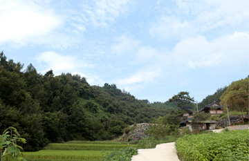
Seokdaesan Mountain features picturesque, unique rock formations and is the home of the ancient Dansoksa Temple, dating back to Shilla. The name of the mountain includes the letter “dae”, which is associated with the name of famed steep and rocky mountains, but in reality, the rocks of Seokdaesan Mountain are not particularly grand in scale or precipitous as may be imagined from the name. However, the strange and picturesque rock formations form a pleasing pattern as they stand their ground stolidly. The landscape of Seokdaesan Mountain is regarded to have a particularly propitious site, especially when viewed from the entry.
Songuisan Mountain is in the northern part of Sancheong and though it is low in height, it is a mountain that shouldn’t be missed for visitors who wish to make a thorough tour of the mountains in Sancheong. According to tradition, the area at the foot of this mountain was the birthplace of many sons famed for their filial loyalty, and the landscape here seems to give a tangible expression to their spirit of devotion.
In Hanjae Village, located at the foot of Songuisan Mountain, there is a monument on which it is written: “Monument to the Filial Piety of Gang Cheo-mun.” Gang is a man who is said to have been exceptional in his strong filial piety. According to legend, Gang’s parents had a fondness for the dishes that were served in ancestral memorial ceremonies which were traditionally observed in each household, and each night without fail, Gang would go around his own village and others nearby, asking neighbors to share their ceremonial rice so that he could serve it to his parents.
One day, on the last day of the lunar month, he went a long distance to find a house where he had been told the ceremony was being observed he explained his situation to the head of the house and received some of the ceremonial rice and headed home. On this night, however, the moon had waned and the skies were cloudy, and he could not see an inch ahead in the darkness he lost his way home.
Even as he wandered, he preciously guarded the food for his parents. Suddenly, he was surprised to see two lights approaching—but when the lights got closer, they turned out to be the glint shining from the eyes of a tiger. Gang was startled, but as he hesitated, the tiger turned and gestured with his tail to instruct Gang to climb on his back. Once Gang was secure on the tiger’s back, the beast ran like the wind and dropped him off in front of his house, and Gang was able to serve is parents as usual. Later, these beloved parents passed away, and the burial took place in the wintertime.
Gang had to carry the bier across a river, but the rain had made the river impossible to cross. When Gang, a man of such deep filial piety, wailed in sorrow, the rivers stopped in its course to allow him to cross and complete the funeral safely. Rumors of these events spread far and wide, and Gang was praised as a son who was blessed by the heavens for his filial love, and a monument was erected in his honor during the reign of King Myeongjong of the Joseon.
Wangsan Mountain, where there remains the Royal Tomb of King Guhyeong, who saw the destruction of Garakguk, and a shooting stand which was used for archery by Kim Yu-sin, the renowned historical figure who led the unification of the Three Kingdoms and Pilbongsan Mountain, which is regarded as a symbol of Sancheong, which is proud to have been the home of many Confucian scholarly elite in the past—these are some of the all attractions we can find in Geumseo-myeon, Sancheong-gun. The name Wangsan Mountain is also associated with memorable stories.
There are in fact a surprising number of stories related to the ancient kingdom of Garakguk that are associated with the Jirisan Mountain region. The places that retain legendary associations with the Garakguk Kingdom include Gitdaebong Peak, which connects Wangsan Mountain to Jirisan Mountain, Wangdeungjae Pass, which still has remains from the site of a fortress, Gukgol, located in the direction of Chilseon Valley. Gitdaebong Peak (whose name means “flagpole”) is where the flag that symbolized Garakguk was once raised. The name “Wangdeungjae Pass” came about because it is said to have been climbed by a king, and there are remains of earthen work fortress in this area.
“Gukgol” means “the valley where there was a kingdom,” and this area has places with names such as “Dujiteo” (meaning “the place where grain was stored”) and “Eoleumteo”. The village of Chuseong-ri located at the entry to the Chilseon Valley also takes its name from the Chuseongsanseong Fortress, which once stood here in Gukgol. Garakguk is often thought of as a country that has become lost to history, but the landscape of Jirisan Mountain keeps its memory alive by embodying its local legends.
Most mountain-climbers choose the trail along the stone fence of the royal tomb that has a spring on the ridge. You’ll climb a rather steep trail for around 5 minutes, but you’ll soon reach a gentle dirt road that continues for quite a distance through the middle of a pine forest. Follow this pathway for around 1 hour and you’ll reach a broad, grassy field with a wide prospect.
Hike for around 10 minutes along this small pathway and you’ll come to the top of the main ridge. In around 1 hour and 40 minutes after starting out from the Royal Tomb of King Guhyeong, you’ll reach the top of a slim pass named “Yeosugogae Pass.” The terrain in the final stretch of ascent can become quite slushy in the winter when the temperature can rise and dip. Once you get to the top of Yeougogae Pass, where the view of the undulating silvergrass is a delight, you will see Pilbong Peak on your right side and the Wangsan summit will be on your left. In fact, however, the summit of Wangsan Mountain is rather difficult to distinguish. From a distance, it is hard to tell if the Wangsan Mountain summit is the rounded peak that you see straight ahead, or the rocky peak with jagged edges.
Viewed from Yeougogae Pass, Pilbong Peak has a very distinct shape, whose image may recall different associations depending on the viewer. Some people compare it to the curvy tip of a writing brush, which is in accordance with the name Pilbong Peak or Munpilbong Peak (which have characters that mean “writing”) but some associate the shape with the curves of a woman’s breast and call it by nicknames such as “Yubangbong Peak” or “Yudubong Peak” (which respectively mean “breast peak” or “nipple peak”). Pilbongsan Mountain is 75m shorter than nearby Wangsan Mountain but the shape of the mountain is memorable, and is more likely to attract your gaze. As can be seen, the summit of Pilbongsan Mountain consists only of chunks of rock that are sharp-edged, and the surroundings are sharp in incline; therefore, it is difficult to reach from any direction other than the trail from Yeoujae Pass.
Standing on this summit, where giant rocks gather to form a rocky peak, Pilbong Peak will appear close enough to touch, and you will be treated to a sublime view of the Sancheong-eup region and the long stretches of Gyeonghogang River and Eomcheongang River. You will be able to observe at a single glance the unbroken flow of the lower slopes, extending from Cheonwangbong Peak in Jirisan Mountain to all the way Ungseokbong Mountain.
To descend, simply follow the path that runs straight down from the summit. The trail is steep, and can become quite slushy in the winter. Avoiding this steep incline is the very reason it is usually recommended that you go in the direction along the stone fence of the royal tomb at the start of the hike. After you have climbed down through the pine forest for quite a while, you will encounter a rock named “Manggyeongdae Terrace.” Manggyeongdae Terrace is associated with the memory of a member of the scholarly Confucian ruling class who demonstrated his determination to uphold the Confucian principle that “a loyal servant does not serve two kings.” When the Goryeo Dynasty declined, Nongeun Minanbu, who had once served as a Minister in the Goryeo government, averred that a man that served as a leader of Goryeo cannot serve in the Joseon Dynasty, and first retreated to Dumundong and then retired to his rural home in Sancheong. It is said that into assuage his sorrow regarding the decline of his country, Nongeun Minanbu used to climb to Manggyeongdae Terrace and gaze in the direction of Songdo (once the capital of the Goryeo Dynasty).
Ungseokbong Mountain was registered as an official County Park in November 23, 1983. Ungseokbong Mountain appears to flow down from Jirisan Mountain, yet it also offers the best vantage point for admiring the scenery of Jirisan Mountain.
The mountain range that begins from Cheonwangbong Peak is linked through Jungbong Peak and Habong Peak and then continues through Ssukbatjae Pass, Saejae Pass, Oegogae Pass, Wangdeungjae Pass and Gitdaebong Peak. Once it reaches Bammeorijae Pass, the slopes rise up once more: this last souring mountain is Ungseokbong Mountain.
When you look at Ungseokbong Mountain from the direction of Sancheong-eup, it appears like a fence that embraces Sancheong-eup. It rises as though blocking out Jirisan Mountain, and contributes its valley water to the Gyeonghogang River which curves around Sancheong-eup. When autumn arrives, the whole mountain appears to be aflame in the splendidly colored leaves.
The name of Ungseokbong Mountain means “Bear Rock Mountain,” and it is thus called because the slopes are steep and harsh, and a legend claims that a bear fell and died here, or because the shape of the mountain resembles a bear. The climb begins once you pass by Jigoksa Temple. Once you pass Jigoksa Temple and pass the point where the main and side branches of Ungseokbong Mountain converge, you find yourself entering the mountainous trail. If you climb toward the right side, you will find a hiking trail that leads to gentle slopes; if you choose instead to enter the valley, the hiking trail will be steeper but you will have the pleasure of admiring Seonnyeotang Valley, which has been named one of the Top 100 Scenic Sites of Korea by the Korean Association for Conservation of Nature. Whichever direction you go, you will still be able to reach the mountain ridge, so can choose the path according to your preference.
Ungseokbong Mountain is a separately standing mountain, but it is also adjacent to Jirisan Mountain. Anyone who knows a thing or two about mountain-climbing in Korea is ambitious to complete the grand hike that stretches 33km, ascending Ungseokbong Mountain, hiking through Bammeorijae Pass, Wangdeungjae Pass, and Ssukbatjae Pass, and reaching Cheonwangbong Peak. Gitdaebong Peak and Wangdeungjae Pass have a unique mystique, associated with the legends of the fallen kingdom of Garakguk. Behind the Royal Tomb of King Guhyeong, there rises the mountain named Wangsan Mountain (which means “King’s mountain”); furthermore, in the marshland of the area named Wangdeungjae Pass (which means “the place the King climbed”), we can still find the traces of a castle site and various legendary stories associated with Garakguk that remain alive in the oral tradition of the elderly villagers.
Wolmyeongsan Mountain forms the boundary between Anbong-ri, Sinan-myeon and Jungchon-ri and is positioned on the right side of the entryway to Seonyudong Valley in Anbong-ri. It is highly sought as part of the mountain climbing course that links Jeokbyeoksan Mountain, Baengmasan Mountain, and Wolmyeongsan Mountain. Each year, New Year’s celebration events are held at this site.
You have a couple of options for going mountain climbing: you can start hiking along the Forest Trail in Hachon Village in Jungchon-ri, Sinan-myeon and begin climbing after parking your car near Wolmyeongsa Temple, or you can begin at the hiking trail at the entry road to Suweol Village in Anbong-ri.
Like Gugoksan Mountain, Gamtubong Peak and Ibangsan Mountain are satellites of Jirisan Mountain and are attractive slopes that you can hike at your discretion, especially when climbing all the way to Cheonwangbong Peak is impractical. One caveat is that the hiking trails are not very distinct, and therefore you should be confident in your independent hiking and navigating skills to ensure that you have a pleasant time. This mountain has immense appeal because its forest is preserved in its primeval state; it is highly recommended as a hiking destination.
In front of Deokgyori Village, near the entry to the hiking trails of Ibangsan Mountain, there is a place called Pagujeong: the name refers to the historical significance of this site in association with the Japanese Invasion of Korea in 1592. Here, Korean soldiers led by three brothers from the Son family lay in hiding and surprised the Japanese invaders and succeeded in destroying the enemy forces.
Ibangsan Mountain, which stands upright between Samjang-myeon and Sicheon-myeon, is a deeply significant historical site where, during the Japanese Invasion of Korea in 1592, men were rallied and recruited to fight as soldiers in the cause of justice (the soldiers were hence called “uibyeong”). This region is full of the traces of this struggle. From Deokgyo-ri in Samjang-myeon, once you climb over Ibangsan Mountain which rises to an altitude of 600m above sea level, you will arrive at a place called Mageundam, in Sa-ri, Sicheon-myeon: this is a deep and secluded mountain valley unfrequented by visitors, formed by a split in one of the southern branches of Ungseokbong Mountain.
The appeal of Jeokbyeoksan Mountain is not its height, but its accessibility as a pleasant hiking course even for senior citizens and its proximity to nearby historical sites that are great for including in your tour. In the summer, visitors can enjoy the attractions of both the river and the mountain.
In the fall, Jeokbyeoksan Mountain (the name of which means “red cliff”) appears dyed crimson by the colorful leaves. In centuries past, when the full moon rose above the slopes, and the chill breezes from the river and the bright moonlight added to the atmospheric beauty, people used to party deep into the night on boats floating on the river. According to an ancient tale, one day, a rock plummeted from the top of the precipice to the river, destroying the pleasure boat on which the lord of the castle was riding. The man fell in the river, and the official seal of government was lost along with him.
The place name derives from names of locales in China, and is meant as homage to the outstanding scenic beauty of this region. Inspired by the ode to the red cliff in the writings of So Dong-pa here there is a local association named Gibang(the house of the professional female entertainers)-gye where people gather in autumn, on the 16th of the seventh month of the lunar calendar and enjoy the pleasures of poetry and boating. The presence of the old dock named Sinanjin was probably another reason this spot attracted so many passersby. There are countless poems that praise this locale, testifying to the power of it scenic beauty to move hearts and inspire aesthetic mediation.
Jeongsusan Mountain is the location of the ancient Yulgoksa Temple and one of its leading attractions is Saesinbawi Rock, which is beloved among many rock climbers for training. The mountain is spread across Naesu-ri, Sancheong-eup, Sancheong-gun, Gyeongsangnam-do and Cheokji-ri and Yulhyeon-ri, Sindeung-myeon, and is known for the purity of its waters.
Topographically, this mountain is at the center of all the other mountains within Sancheong. The hiking course starts from the parking lot of Yulgoksa Temple, ascends through Saesinbawi Rock, the crossroad, and Jeongsusan Mountain, and then descends in the reverse order.
Saesinbawi Rock is a single rock that rises 60m high and is 40m wide; it is just as appealing to rock climbers as the well-known Munbawi Rock in Geumwonsan Mountain, which has been claimed to be the best among single rocks in Korea. The shape of Saesinbawi Rock resembles a seated bird; as you are climbing up, the rock appears to be a single, solid immensity but once you reach the summit of the rock, you’ll notice that rocks of various sizes have converged to create the impression of a single great rock.
The views of the ridge and the peak (where there is a stone marker for triangulation), when seen from the vantage point of Saesinbawi Rock, are inexpressibly gorgeous. Moreover, the ancient trees that are found on Saesinbawi Rock have a certain fascination; the sight of these pine trees that have sustained their lives by burrowing their roots into the hard terrain of Saesinbawi Rock is bound to inspire you to reflect on the greatness of all living things, on the greatness of life itself, and certainly add poignancy to the scenery of Jeongsusan Mountain.
After you pass the crossroad and ascend to the summit of Jeongsusan Mountain and then proceed 50m further past the first summit stone, you will arrive at another stone summit marker. The summit of Jeongsusan Mountain gives an inviting and comforting impression, as familiar as the gentle slopes of your neighborhood hillock. The observatory on Jeongsusan Mountain gives you a broader prospect than the view from Saesinbawi Rock. The descending trail has many steep sections, so be sure to take extra caution on the way down.
Jusan Mountain is a satellite of the Jirisan Mountain: the range stretching south from Samsinbong Peak gradually turns eastward and then soars up once more in Naegong-ri, Sicheon-myeon and this peak is what is known as Jusan Mountain. If we were to compare Cheonwangbong Peak in Jirisan Mountain to the head and torso of a body, then the range that stretches all the way down to Jusan Mountain is like a long right arm that holds Gugoksan Mountain in its embrace.
On the ridge and prospect points atop Jusan Mountain, you can enjoy an outstanding scenic view, including the Cheonwangbong Peak of Jirisan Mountain and numerous other peaks in the distance in a single glance. The appeal of Jusan Mountain is not so much its own scenery but the vantage points that it provides for admiring the mountainous scenery of Jirisan Mountain and its neighboring peaks we may thus describe it as a mountain that has the virtue of humility, enabling the splendor of others to shine rather than boasting its own beauty.
The name “Jusan Mountain” contains the character “ju” which means “king.” One can imagine that if the king himself had to choose a prospect point on occasions when he cannot ascend Cheonwangbong Peak itself, Jusan Mountain would be the perfect choice. As in the case of Gugoksan Mountain, Jusan Mountain is a satellite of Cheonwangbong Peak, and is a fully satisfactory alternative when you are unable to climb Cheonwangbong Peak itself. Moreover, Jusan Mountain allows you to indulge in the scenic views of Jirisan from Jungsan-ri, views which is unavailable from Gugoksan Mountain. Jusan Mountain is an important prospect point for observing Cheonwangbong Peak, connecting Samsinbong Peak and Yeongsin Peak. Jusan Mountain often hides itself under the groves of upland bamboo that flourish in its ridges and valleys. This mountain is therefore a wonderful sanctuary for mountain wildlife.
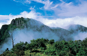
Jirisan Mountain has been honored as one of the “three sacred mountains” of Korea along with Geumgangsan Mountain and Hallasan Mountain. In the traditional list of five great mountains celebrated since the Shilla Period, Jirisan was referred to as “Namak.” There is a saying that “even a foolish person transforms into a wise person after staying here” and thence derived the name “Jirisan Mountain”. Jirisan Mountain is also known by the name “Duryusan Mountain” which refers to the belief that the force that originates from Baekdusan Mountain flows down through the peninsula all the way to this mountain. Yet another name for this mountain is “Bangjangsan Mountain”: in the Buddhist tradition the word “bangjang” refers to the place where a priest who has attained enlightenment resides.
Designated a national park on December 29th, 1967, Jirisan National Park was the first officially registered national park in Korea. This park stretches across three provinces, 5 cities and “gun” districts, and 15 “eup” or “myeon” sub-districts including Hadong-gun, Sancheong-gun, and Hamyang-gun, Gyeongsangnam-do, Gurye-gu, Jeollanam-do and Namwon-si, Jeollabuk-do. It covers an area of 440.517㎢. This is 7 times the size of Gyeryongsan Mountain National Park and around 52 times the area of Yeouido in Seoul. Among the 20 National Parks, this is the largest when compared in terms of land area only.
Jirisan Mountain has a series of ten or so steep, high-rising peaks, including Cheonwangbong Peak (1,915.4m), which is the second highest peak in Korea, as well as Jeseokbong Peak (1,806m), Banyabong Peak (1,732m), Nogodan Peak (1,507m) and the distance of the main ridge stretching from Cheonwangbong Peak to Nogodan Peak is 25.5 km. The circumference of Jirisan is 320km.
Numerous valleys including Chilseon Valley, the waters of which originate from Cheonwangbong Peak, Baemsagol Valley, and Daewonsa Valley, along with outstanding scenic spots such as Buril Falls, Guryong Falls and Yongchu Falls give Jirisan Mountain a place of honor even among other famed mountains. Moreover, this mountain is a vital center of Buddhism in Korea and is home to great temples including Hwaeomsa Temple, Ssanggyesa Temple, Yeongoksa Temple, Daewonsa Temple, and Silsangsa Temple as well as numerous smaller hermitages and other cultural heritage sites.
Jirisan Mountain is also a life-giving mountain that provides a habitat to countless plants, animals as well as people. From the main ridge that runs from Cheonwangbong Peak to Nogodan Peak, 15 branching ridges and valleys spread out north and south in the appearance of two outspread hands. This landscape is the habitat of 245 species of woody plants, 579 species of herbaceous plants, 15 families and 41 species of mammals, 39 families and 165 species of birds, and 215 species of insects.
The grand scale of Jirisan Mountain can be perceived just by observing its rivers, peaks and passes. The rivers originating from Jirisan Mountain are Deokcheongang River, Eomcheongang River, and Hwangcheongang River. Jirisan Mountain has over 20 mountain peaks, and there are over 50 famed observatory points and rocks. According to historical records, there were once around 350 temples and hermitages in Jirisan Mountain. There are countless traditional tales and cultural heritage treasures associated with this mountain. Jirisan Mountain is associated with legendary tales about figures including Mayago, Banya Dosa, Hoya and Yeonjin, and has been idealized as a utopian place of legendary gods. Even without taking into account the records indicating that there are 350 sites of temples and hermitages that existed in Jirisan Mountain or the fact that the Jirisan Mountains has yielded 7 registered National Treasures, 26 Treasures, numerous Regional Cultural Heritage, major Historic Sites, and folklore materials, Jirisan Mountain would be astounding in and of itself. Jirisan Mountain needs no extra credentials to prove its merit.
Jiphyeonsan Mountain: Saengbiryang-myeon is known as the region where the venerable Biryang, a Buddhist priest who attained spiritual enlightenment, practiced his good deeds.
Jiphyeonsan Mountain was previously known as Chilpyeongsan Mountain, a name which meant that the area of the summit was believed to have an area of seven (“chil”) pyeong (a unit of measurement), or as “Chilbong Mountain,” which meant that there were seven peaks. Jiphyeonsan Mountain is spread along the boundary between Saengbiryang-myeon, Sancheong-gun and Jiphyeon-myeon, Jinju-si.
The mountain is arranged in the shape of a horseshoe, and the round-trip hiking course along the ridge is 10.8km. Ensconced within the horseshoe shape is Hyeondong Village: Jiphyeonsan Mountain appears to be in the shape of two hands gently holding the village. From the summit, you have great views of the handsome peaks on the ridge across the way, including Bubong Peak, Janggunbong Peak, and Kkamagwibong Peak, and this is an excellent spot to view the sunrise. From atop Bubong Peak, you have delightful views of Jinju, Jinyangho Lake, Sancheong-gun Wonji, Ungseokbong Mountain, and Jirisan Mountain, and views of the landscape and the sunrise are particularly good here since there are no tall mountains nearby.
Taebongsan Mountain, located in Saengcho-myeon, is not a tall mountain but it has historically significant ancient tombs. Scattered at the foot of Taebongsan Mountain, there are dozens of ancient tombs of varying external size, which have been designated as Gyeongsangnam-do Monument 7. Over the centuries, however, many have been exposed to thievery and land clearing, and only few of them still retain their original form.
Considering that the Royal Tomb of King Guhyeong, the last king of Garakguk, is located not far from these ancient tombs, we can deduce that there must have been sites where gold and iron were produced nearby, influencing the rise of powerful tribes in this area.
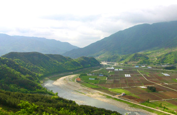
Near the site of the ancient tombs, there is a very old mountain fortress. It is called 'Eooesanseong Fortress' and is also nicknamed 'Cheokdongsanseong Fortress.' This stone fortress was built on top of a precipice on the riverside, overlooking a broad plain. On one side is Bontongjae, on the route of Samnam-daero which that leads to the capital city, Seoul. This was historically a key nexus point for transportation: in the past, once one passed over Bontongjae near Imcheonwon, one arrived at the old Sageundo Station, which was where the appointed official known as Sageun Chalbang was deployed. Around the 7th century, this was the border region between the kingdoms of Shilla and Baekje, and therefore the site of frequent clashes.
Gangjeong, located below Bontongjae, has clear streams and outstanding scenery and is frequented by visitors each season. The water of Imcheon Stream, which originates in the northern part of Jirisan Mountain and flows through Macheon, converges with the water of Namgye and Wicheon Stream, which flows south from Deogyusan Mountain to form Noegye at this spot. In the summer, the sandy beaches that have been formed by the two branches of streams provide the perfect setting for sunbathing and revitalizing your body in the cool river water. Enjoy a meaningful date with your beloved or bring your whole family in the sultry summer and visit Taebongsan Mountain to play in the cool water and immerse yourself in the picturesque scenery and clear air of Sancheong.
Hwajangsan Mountain and Suyangsan Mountain are beloved summer hiking destinations and are highly recommended, along with Deokcheongang River, for your next vacation season. A special attraction of this mountain is the clear waters of Deokcheongang River.
In Hwajangsan Mountain, there remains the site of Hwajangam Temple. Hwajangam Temple is mentioned in old records such as ‘Jinjuji’, clearly indicating that the temple was built at a very early date; it was once positioned halfway up a high mountain at around 600m above sea level.
It is said that there were also other temples nearby including Hallimsa Temple, Baegunam Hermitage, and Yongmunam Hermitage, but all of these have now vanished. However, artifacts from the Bronze Age have been excavated and 5 items including knives and spears are now preserved in the Gyeongju National Museum. 1km northwest of Jeomchon Village is a site where rocks are piled in many layers, which is known as Iron Head. In rock caves at this site, there are traces indicating that gold, silver and bronze were excavated here, and Jeomchon Village was a place of key importance where iron manufacturing was performed at the time, as evidenced by the remains of iron oxide, etc.
Hwangmaesan Mountain is located in Beoppyeong-ri, Chahwang-myeon, Sancheong-gun, Gyeongsangnam-do and its name originally meant “large (or broad)” mountain in Korean, and this was transcribed into Chinese characters to become “Hwangmaesan Mountain.” Hwangmaesan Mountain is the last of the lofty peaks in the Taebaek Mountain Range and is famed as the place where the Buddhist Monk Muhak, renowned for his role in national self-defense, performed his ascetic self-discipline during the Goryeo Dynasty. Stretching southeast from the central point in Hwangmaebong Peak in San-1 Beoppyeong-ri, Chahwang-myeon, Sancheong-gun, Gyeongsangnam-do, there are cliffs with picturesque rock formations, with a scenic beauty that makes this mountain merit the title of “Little Geumgangsan Mountain.”
In the name “Hwangmaesan Mountain,” the character “hwang” signifies wealth and “mae” signifies something precious, and thus overall the name symbolizes abundance. It has long been believed that anyone who prays here with sincere piety will have at least once of their wishes come true, and this legend has attracted many famous historical figures to this spot.
Hwangmaesan Mountain undergoes splendid transformations each season of the year. In the spring, azaleas embroider the greenery with pink; in the summer, the streams of the valley pour from the foot of the mountains and abundantly replenish the Gyeonghogang River; in the autumn, silvergrass give forth white blossoms like lit candles; in the winter, there is much silvery snowfall, a rare sight among the mountains of the southern regions.
Hwangmaesan Mountain is encircled by Jirisan Mountain, Deogyusan Mountain, and Gayasan Mountain but stands proud and independent, giving it the dignified appearance worthy of a renowned mountain.
The name “Hyoryeombong Peak” was given because it was said that many men and women of exemplary filial piety lived below this mountain. The name also meant that the residents below the mountain were frugal. This is the mountain from which you get the closest view of the festival of royal azaleas that forms a spectacle on Hwangmaesan Mountain and Buamsan Mountains along with the picturesque view of the unique rock formations. From a certain level, the mountain’s shape is similar to a general wearing a battle helmet.
One strand of Hwangmaesan Mountain flows southwest and then stops to soar upward: this formation is known as Hyoryeombong Peak. It has a daring appearance, and it is fascinating how the shape seems to change depending on the angle of the viewpoint. Once you reach the top of the summit at 636m, there is a flat rock surface that is broader than it seemed from a distance, and provides a resting spot for perspiring mountain climbers.
This mountain has three naturally formed rock caves. Their names are Beteul Cave, Bakjwi Cave, and Nuun Cave. Beteul Cave is named thus because the rock appears to be weaved like thread on a loom, and it is spacious enough for 6 to 7 people to enter. Bakjwi Cave opens onto a cliff. Nuun Cave, as described by its name (which means “the cave lying down”) is a low-lying cave that can fit 50 to 60 people.
In Cheolsugol, at the bottom of Hyoryeombong Peak, there is a pond named Yongso. As one can tell from the origin of the name, a deep pool was created at the point where a broad rock forms a precipice. The surrounding scenery is beautiful and attracts vacationers in the summer. Here too, one can find traces of Confucian scholars who gathered here, engraving writing on the rocks and erecting monuments. In the past, when there was a draught, people sometimes held ceremonies praying for rain at this site.
A mountain from which one gazed at the distant Namhae Sea and longed for one’s beloved. This peak was named “Manghaebong Peak” because it was said that you can see the distant sea from the summit of the mountain. Manghaebong Peak is not particularly rugged or high in altitude, and therefore it may seem uninteresting to discuss this mountain based on its terrain alone.
However, the peak offers a marvelous view of the gently flowing Namgang River, and on days with fine weather, you can even see as far as the Namhae Sea. It is surrounded by many mountains and other nearby scenic features include Geoboesa Temple, the historical “First Cotton Farm” in Korea, Danseong-myeon office site, Sindeung-myeon office site, and the Daejeon - Tongyeong expressway.
A mountain is a mountain! Water is water!
Geomubong Peak was so named because the mountain is shaped like a dancer performing a sword dance. Geomubong Peak rises like a silent sword dancer in front of Geoboesa Temple, the site of the former residence of Monk Seongcheol, and the Namgang River flows so subtly that it appears to be still. From the prospect point atop Geomubong Peak, one can imagine the stern voice of Monk Seongcheol.
“A mountain is a mountain! Water is water!” To mankind, who are trapped in our various worldly obsessions, desires and anguish, this simple statement is meant to convey a wisdom that will open our hearts and lead us to nirvana. Standing on Geomubong Peak, you can see the serene Jirisan Mountain in the far distant western skies, where the sun sets, and gaze down at the ceaselessly flowing, gentle waters of the river. From this vantage point, you will indeed see the mountain clearly as a mountain and the water as water.
The mountain were the scholar Nammyeong spent his days with his feet immersed in the stream of Baegun Valley
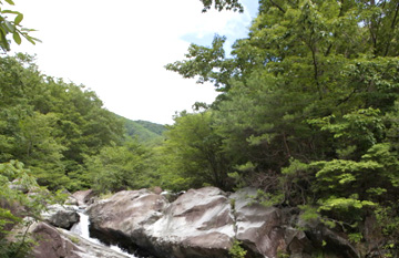
The range of Jirisan Mountain passes through Ungseokbong Mountain and continues south toward the Deokcheongang River and then divides into three branches. Mageundam Valley and Baegun Valley flow between these branches. Baegunsan Mountain is the mountain that gives forth the icy, clear and blue water that fills the Baegun Valley.
This place was probably named “Baegun (white cloud)” because Baegunsan Mountain often blocks the white fogs in Baegun Valley, causing white clouds to form frequently. Baegun Valley is 4km long, and has numerous falls and pools, some famed and some hardly known, which provide scenic beauty and a cool place to rest for hikers and those who simply love playing in the water. The revered Confucian scholar Nammyeong Jo Sik also frequented this place to indulge himself in the pleasures of nature.
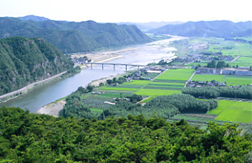
A mountain shaped like a fish that frolics in the Gyeonghogang River and the Yangcheongang River
Eomhyesan is a mountain that stands erect at the point where Gyeonghogang River converges with Yangcheongang River. If you look down at this mountain from the heights of Jirisan Mountain, the shape of the mountain resembles the tail of a fish, and was therefore called “eomi (fish tail)” mountain and the pronunciation evolved into its current name, “Eomhyesan Mountain.”
The surrounding river encircles Eomhyesan Mountain, creating a harmony between river and mountain. When observed from one of the nearby mountains or from the sky, this mountain is shaped like a fish with its tail stuck out above the water, and its head and body immersed in the Namgang River. Gazing at the western skies from the riverside cliff, wafted by the cool river breeze, you can take in the sights of the neighboring mountains, including the famed Cheonwangbong Peak of Jirisan Mountain, in a single glance. The range of Jirisan Mountain and the Daltteugi Ridge of Ungseokbong Mountain and the range of Seokdaesan Mountain appear as though layered atop one another, resembling giant sheets of laundry stretched out and hung to dry. Analogous to the water that drips from the laundry are the tributaries that form Gyeonghogang River and Namgang River, which flow onward serenely.
Transforming a vertical culture into a horizontal culture Jirisan Dulle-gil Trail refers to a long-distance walking trail that stretches around 300km around Jirisan Mountain, a project sponsored by the “Supgil” Corporation with the support of the Korea Forest Service. In the five cities and gun-districts (Gurye/Namwon/Hadong/Sancheong/Hamyang) and around 100 villages located in the 3 provinces that embrace Jirisan Mountain (Jeonnam/Jeonbuk/Gyeongnam), existing paths including the old trails of Jirisan Mountain, trails along the mountain passes, forest paths, riverside walkways, paths on the banks of rice paddies, village roads, and others have been connected to form one continuous trail.
Among these, the Jirisan Dulle-gil Trail is linked to Sancheong and spans from course 5 to course 9, a total of 5 sections, with a total distance of 60.2km. The Sancheong region is a 56.7 km-long section that ranges from the Memorial Park for Sancheong and Hamyang Incidents to Sicheon-myeon Galtijae. As you walk along the Jirisan Dulle-gil Trail you will encounter the region’s history, culture, and village life. The Jirisan Dulle-gil Trail serves as a forum where teachers, students, friends, children and local residents can meet one another. We hope that as you walk this path, you will experience it as a kind of pilgrimage where you meet nature, village life, and the local culture and ultimately get in touch with your inner self and find solace for your soul. Jirisan Dulle-gil Trail reflects our dream of transforming our speed-obsessed culture into a culture that values slowness and self-reflection, and our vertically driven culture into a more horizontal culture.
Good food is better for you than good medicine, and a good walk trumps good food Donguibogam Dulle-gil Trail is a course that starts from Donguibogam Village in Teuk-ri, Geumseo-myeon, Sancheong-gun and threads through Sina-ri, Hwagye-ri, Jahye-ri, Sucheol-ri, Hyangyang-ri, Pyeongchon-ri, and Teuk-ri, Geumseo-myeon and returns again to Donguibogam Village. It circles around Wangsan Mountain and Pilbongsan Mountain, allowing you to experience the nature, history and culture of the locality and heal your heart and body.
The total distance is 17.4km. When exploring the Donguibogam Dulle-gil Trail, we recommend that you devote special attention to the issue of health. The physician Heo Jun taught that nourishing yourself with good food is better than taking medicine, and building your health by walking is more important than what you eat, and the teachings of Donguibogam convey to us the message that walking is the key to defending your health. Recall this principle taught by Heo Jun as you walk along Donguibogam Dulle-gil Trail and you’ll feel lighthearted as you start, and when you finish exploring the trail, you’ll feel replenished by the healing effects in your heart and body.
The path in honor of the life of Nammyeong, who returned to the solitude of nature and sought to critique contemporary politics in an objective and fair-minded manner.
This course offers many spots with great views of Jirisan Mountain. Cheongjeongmyeonggil was named in reference to the two small metal bells that Nammyeong once wore on his coat string, which we can imagine rang in bright and clear tones. The name of the bell was Seongseongja and the intent of Nammyeong was to wake himself up each time he heard the sound of the bells. We hope this trail will inspire you to reflect on the self-discipline of Nammyeong, who sought to live his life fully awake and attuned to its significance.
Baekyongmun Sayugil (Gyeonguigeomgil) is a course that leads you to Baegun Valley with its white clouds and blue water, and through a long and deep valley called Yongmungol where one can easily imagine the legendary dragon once lingered. The name Gyeonguigeom-gil is a reference to the long sword that Nammyeong carried around. Gyeonguigeomgil was thus named because the sword carried by Nammyeong was inscribed with the saying “Naemyeongjagyeon Oedanjaui.” What are the precious values symbolized by the “Gyeonguigeom” that we must seek on this path? We hope this trail will guide you toward the path of self-reflection, humility, and the pursuit of righteousness.
This trail was named Munmugil, because the disciples of Nammyeong not only pursued literary studies (“mun”) but used this as the basis for their action (“mu”).
During the Japanese Invasion of Korea in 1592 many of the scholarly elite in the Yeongnam region participated in the battles as voluntary “soldiers in the cause of justice (uibyeong)” and helped defend this country.
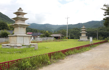
Dansoksa Temple is an ancient temple that was built during the Shilla Period, and survived for centuries until it was destroyed during the war called “Jeongyujaeran” in the Joseon Period but today all that remains are the flagpole supports and the stone pagodas of the east and west: the temple’s erstwhile splendor and grandeur can no longer be seen. This trail reminds us of the lessons of the past that must not be forgotten.
Walking on this course, you can feel the strong, elevated wind that comes passing through Jirisan Mountain, and you can experience firsthand the cold and white streams of water that burst through the Baegun Valley. In Baegun Valley, there is a place called “Nammyeong Janggujiso” where the scholar Nammyeong is said to have rested his cane, immersed his feet in the valley stream, and recited poetry. This course pays homage to the upright man who sought out solitude and sought leisure in his life by befriending nature; we hope you’ll also find renewed appreciation for the simple delights of life.